Hiking Trails
History of hiking trails in the White Mountains, New Hampshire. The hiking trails in the White Mountains are known for being rugged and steep, but how they came to be is often overlooked. Trails that were built in the 1800s and early 1900s are still in use today; and the oldest continuously-used mountain trail in America, Crawford Path in the Presidential Range, is located in the White Mountains. With the use of photography, writing, and research, this work focuses on the White Mountains trail system.
Crawford Path, White Mountains
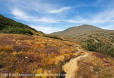
Crawford Path, White Mountains - Crawford Path, located in the White Mountains of New Hampshire, is the oldest continuously-used mountain trail in America, and for a period of time it was used as a horse trail to Mt Washington. This eight and half mile historical path came to be in 1819 when Abel Crawford and his son Ethan Allen began building a trail to the summit of Mt Pierce, formerly called Mt Clinton. Once north of Mt Pierce, the Crawford ...
Davis Path, White Mountains
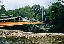
Davis Path, White Mountains - Davis Path, built in 1845 by Nathaniel Davis, son-in-law of Abel and Hannah Crawford, was the third and longest bridle path built to the summit of Mount Washington. After being built the bridle path was neglected, and in 1910 it was reopened as a footpath...[Continue reading] ...
Boott Spur Trail, White Mountains
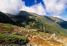
Boott Spur Trail, White Mountains - Boott Spur Trail begins off the Tuckerman Ravine Trail and ends at Davis Path, near the summit of Boott Spur Mountain. At 5500 feet, Boott Spur is named for Francis Boott; an botanist who took part in scientific expeditions to the Presidential Range during the early 1800s. The original route of the trail was opened by the Appalachian Mountain Club in 1900....[Continue reading] ...
An Evolving Landscape, White Mountains
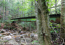
An Evolving Landscape, White Mountains - It amazes me how much the landscape of the White Mountains changes over time. Many visitors to the White Mountains think of the area as being "stuck in time" because of its national forest designation. The reality is lots of change occurs naturally and by man. I thought it would be interesting to show scenes that no longer exist in the White Mountains. These scenes all disappeared over the last ten years....[Continue reading] ...
Mount Osceola Trail, White Mountains
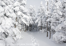
Mount Osceola Trail, White Mountains - The New Hampshire White Mountains have been photographed inside and out and possibly from every vantage point. And it has become common to see identical shots of a location from two, three or four photographers. Some images are so identical it looks as if photographers set up their tripods in the same spot...[Continue reading] ...
Mittersill-Cannon Trail, Cannon Mountain
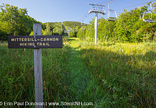
Mittersill-Cannon Trail, Cannon Mountain - In 2012, Senate Bill 217 was introduced to the New Hampshire legislature. The main focus of the bill was the leasing of the Cannon Mountain Ski Area. It also proposed renaming Franconia Notch State Park to Franconia Notch Veterans' Memorial State Park, the building of a veterans memorial and the development of a hiking corridor on Mittersill Mountain...[Continue reading] ...
Shoal Pond, Pemigewasset Wilderness
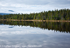
Shoal Pond, Pemigewasset Wilderness - Shoal Pond is a secluded 5-acre pond in the Pemigewasset Wilderness in the New Hampshire White Mountains. The average depth is one foot with a max depth of three feet (source, NH Fish & Game). The definition of “Shoal” is an area of shallow water, so this is likely why the pond was given this name....[Continue reading] ...


ScenicNH Photography LLC
Specializing in environmental conservation and historic preservation photography mainly in the White Mountains region of New Hampshire, Erin Paul’s photography and writing focuses on the history of the White Mountains, and telling the story of abandoned places and forgotten historical sites.